Hiking up
Hurricane Hill Trail out of the Elwha River Ranger Station, I broke the treeline about 4000' above the trail head. The trail cut switchbacks into the steep meadow, and marmot dens dotted the grassland; big, gaping holes in the earth, bringing to mind the Rodents Of Unusual Size (R.O.U.S.) from
The Princess Bride.
I kept a sharp lookout for flame spurts and lightning sand, just to be on the safe side. The climb averaged a 17.5% grade over the first 6 miles, and I had 2.5 miles to go before cresting the hill. I moved steadily up the meadow, gaining a ridge and traversing towards the summit, pausing occasionally to snap a picture as more of the epic horizon came into view.
 |
| Mid-meadow panoramic |
The temperature was perfect and the dramatic skies above
Olympic National Park were dotted with summer thunderstorms.
Amidst a week-long road trip around the Olympic Peninsula in Washington, we were camping on the
Elwha River. Twirly was driving up to the summit of my run to provide me an aid station before I ran back down into the valley via a more gradual trail. We were not travelling that day, so I chose to stretch my legs on a long run with some elevation, getting up high enough to see the lay of the land, which is mostly covered with rain forest.
 |
| Glines Canyon Dam demolition (source) |
The Elwha River is home to the
largest dam removal project in US history. The demolition of Elwha Dam and Glines Canyon Dam (105' and 210' tall, respectively) began in 2011. As of August 2013, the project is on hold due to
issues with sediment and water treatment. Our campsite was below Glines Canyon Dam, and we could see King Salmon spawning in places that had not seen salmon in the 100 years since the Elwha Dam was completed in 1913.
 |
| The Elwha Dam demolition (source) |
 |
| Hurricane Hill is obscured by that knoll |
The Hurricane Hill Trail approaches the summit from the north side. As I neared the peak I found myself surrounded by people enjoying the view. The peak itself resides 650' above the parking lot, accessible by a 1.5 mile trail from the parking lot. Those at the summit had paid their dues getting there, but I still felt out of place amongst the crowd milling around taking pictures of wildlife.
 |
| Look! Deer! |
 |
| Mount Olympus is the far horizon, left center |
I refilled my pack with Tailwind at Twirly's aid station, and set out for the longer, but more gradual, descent into the valley via the Wolf Creek Trail.
 |
| Cool running |
After hiking for 6 miles up the ridiculously steep Hurricane Hill Trail, it felt good to get consistent leg turnover on the decommissioned road that was the Wolf Creek Trail. Overgrown in some places, especially near the bottom, I kept my ears open for bear or elk. The culverts which used to route the runoff beneath the roadbed were clogged, creating quagmires of mud hidden in knee high grass at each creek crossing. I would be cruising along at a good clip and find myself tromping through mud deep enough to swallow a shoe!
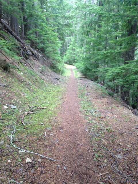
 |
| The Spruce Line |
 |
| Lake Crescent |
Another run of note in Olympic National Park was an 8 mile out and back along the shores of
Lake Crescent along the
Spruce Railroad Trail. As the name implies, the trail followed an old railroad bed along the shore of the 600' deep lake, which is the largest within the Olympic National Park's boundaries. From the trail head, Twirly and I set out into an old orchard overgrown with moss. Within a mile, the trail joins the old railroad bed. The original rail line was 36 miles long and carried Spruce timbers to nearby
Port Angeles, where the wood was sought after for airplane building in World War II. Unfortunately, the Great War ended just days before the line was completed. The rail line did operate for 35 years before the Park Service turned the 4 miles along the lake into trail.
A little over one mile from the trail head at Devil Point, the path crosses a portion of the lake called the Punchbowl. I was amazed at the azure color of the water; despite overcast skies, the deep water shone blue. I tried to capture the color in photos, but failed to do the striking sapphire water justice. The trail continues through a forest of Fir, Hemlock and Madrone, flirting with the water's edge and occasionally climbing over rock fall. Old tunnels used by the rail line have since collapsed, making for some interesting side features and trail detours. Relatively flat and smooth, this trail is a must see for any one running in the Park.
On our return trip from the northern reaches of the park, we followed the Pacific Coast, stopping briefly in Portland before continuing through Tillamook and following the Oregon shore to Florence. Hiking the dunes at
JM Honeyman State Park made for a great sunset, and we wrapped up the trip staying in the coastal redwoods outside Arcata, California in Patrick's Point State Park.
Overall, the road trip was a good reset week for my training. I got some good variety in and didn't push myself too hard. I feel rejuvenated and ready to tackle another training cycle preparing for
North Face 50 by way of a
50k in Stinson Beach in just six weeks.
Onwards, as they say.

 A little over one mile from the trail head at Devil Point, the path crosses a portion of the lake called the Punchbowl. I was amazed at the azure color of the water; despite overcast skies, the deep water shone blue. I tried to capture the color in photos, but failed to do the striking sapphire water justice. The trail continues through a forest of Fir, Hemlock and Madrone, flirting with the water's edge and occasionally climbing over rock fall. Old tunnels used by the rail line have since collapsed, making for some interesting side features and trail detours. Relatively flat and smooth, this trail is a must see for any one running in the Park.


No comments:
Post a Comment